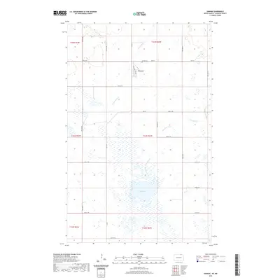
2020 Map of Hannah
USGS Topo · Published 2020About this map
Hannah sits at the northern edge of Cavalier County, just below the international border, where the plains of North Dakota meet the Canadian line. This agricultural landscape is defined by a grid of section lines and a drainage system centered on Snowflake Creek and W Snowflake Cr, which wind through the township toward the marshy expanse of Rush Lake. The small town center of Hannah is organized around 1st Ave and 2nd Ave, serving as the focal point for the surrounding farmsteads. To the north, Hannah Cem serves as a primary genealogical landmark for the community. The map illustrates a highly structured prairie environment, where roads like Co Rd 13 and Lake Rd connect isolated rural residences across the township divisions of T164N R63W and T163N R62W.
Find a feature on this map
30 named features on this map. Tap any name to fly to it.
Don’t see what you’re looking for? This feature index may not catch every label — zoom into the map to look around manually.
Map Details
Editions of this 2020 Hannah Map
This is the sole edition of this map. No revisions or reprints were ever made.
Other maps of this area

1953 · Devils Lake
USGS Topo · 1:250,000

1956 · Devils Lake
USGS Topo · 1:250,000

1970 · Sarles NE
USGS Topo · 1:24,000

1970 · Sarles SE
USGS Topo · 1:24,000

1970 · Hannah SW
USGS Topo · 1:24,000

1970 · Wales
USGS Topo · 1:24,000

1970 · Hannah
USGS Topo · 1:24,000

1970 · Hannah SE
USGS Topo · 1:24,000

1985 · Langdon
USGS Topo · 1:100,000
2011 · Hannah SW
USGS Topo · 1:24,000