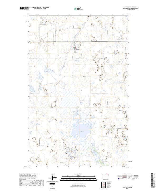
2024 Map of Hannah
USGS Topo · Published 2024About this map
Hannah sits at the center of this northern North Dakota survey, positioned along the rural grid where Co Rd 13 meets 108th St. The township-and-range lines of the Public Land Survey System divide the terrain into predictable sections, yet the landscape is defined by the irregular presence of water. The meandering West Snowflake Creek and Snowflake Creek cut across the northern sections, while the large basin of Rush Lake dominates the southern portion of the quadrangle. These water bodies, along with numerous smaller wetlands and depressions, illustrate the typical prairie pothole region of Cavalier County. To the north of the settlement, Hannah Cem serves as a primary point of local history for those tracing family roots in this borderland area. The map documents a mature agricultural network of section-line roads, including 94th Ave NE and 101st St NE, which facilitate movement between the scattered farms and the central town site.
Find a feature on this map
28 named features on this map. Tap any name to fly to it.
Don’t see what you’re looking for? This feature index may not catch every label — zoom into the map to look around manually.
Map Details
Editions of this 2024 Hannah Map
This is the sole edition of this map. No revisions or reprints were ever made.
Other maps of this area

1953 · Devils Lake
USGS Topo · 1:250,000

1956 · Devils Lake
USGS Topo · 1:250,000

1970 · Sarles NE
USGS Topo · 1:24,000

1970 · Sarles SE
USGS Topo · 1:24,000

1970 · Hannah SW
USGS Topo · 1:24,000

1970 · Wales
USGS Topo · 1:24,000

1970 · Hannah
USGS Topo · 1:24,000

1970 · Hannah SE
USGS Topo · 1:24,000

1985 · Langdon
USGS Topo · 1:100,000
2011 · Hannah SW
USGS Topo · 1:24,000