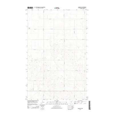
2014 Map of Hannah SW
USGS Topo · Published 2014About this map
Forest Airport serves as a lone modern landmark in this section of Cavalier County, where the landscape is defined by the rigid precision of the Public Land Survey System. The map reveals an intricate network of section-line roads, such as 90th Ave NE and 93rd St NE, which carve the prairie into a distinctive grid. This geometric pattern illustrates the late-stage organization of North Dakota's agricultural interior, where transportation was built directly onto the township and range lines to serve isolated farmsteads. Unlike earlier surveys of the region, this modern topographic study uses a five-foot contour interval to meticulously document the subtle depressions and rises that characterize the local terrain, offering a clear view of how drainage and land use follow the strict cardinal orientation of the northern plains.
Find a feature on this map
15 named features on this map. Tap any name to fly to it.
Don’t see what you’re looking for? This feature index may not catch every label — zoom into the map to look around manually.
Map Details
Editions of this 2014 Hannah SW Map
This is the sole edition of this map. No revisions or reprints were ever made.
Other maps of this area

1953 · Devils Lake
USGS Topo · 1:250,000

1956 · Devils Lake
USGS Topo · 1:250,000

1970 · Alsen
USGS Topo · 1:24,000

1970 · Sarles NE
USGS Topo · 1:24,000

1970 · Sarles SE
USGS Topo · 1:24,000

1970 · Hannah SW
USGS Topo · 1:24,000

1970 · Wales
USGS Topo · 1:24,000

1970 · Hannah
USGS Topo · 1:24,000

1970 · Loma
USGS Topo · 1:24,000

1970 · Hannah SE
USGS Topo · 1:24,000