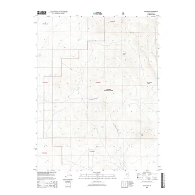
2014 Map of Hannapah
USGS Topo · Published 2014About this map
The Monitor Range dominates this portion of Toiyabe National Forest, where the high desert landscape is defined by its critical water sources. This 2014 survey documents a network of named springs that have historically sustained life in this arid region of Nye County. Features such as Woodchopper Spring, Thunder Mountain Spring, and Cedar Corral Spring are scattered across the terrain, suggesting the vital importance of these points for both wildlife and human activity. The elevation shifts significantly toward Red Peak and through the depths of Woodchopper Canyon, illustrating the high-relief topography of the Great Basin. Access is primarily limited to the Natl Forest Develop Road 491 Rd, highlighting the isolation of these mountain slopes. For researchers, the map provides a precise look at the township and range boundaries that partitioned this territory, including t4n r45e and t5n r45e.
Find a feature on this map
19 named features on this map. Tap any name to fly to it.
Don’t see what you’re looking for? This feature index may not catch every label — zoom into the map to look around manually.
Map Details
Editions of this 2014 Hannapah Map
This is the sole edition of this map. No revisions or reprints were ever made.
Other maps of this area

1907 · Tonopah
USGS Topo · 1:250,000

1908 · Tonopah
USGS Topo · 1:250,000

1956 · Tonopah
USGS Topo · 1:250,000

1959 · Tonopah
USGS Topo · 1:250,000

1961 · Tonopah
USGS Topo · 1:62,500

1962 · Tonopah
USGS Topo · 1:250,000

1963 · Baxter Spring
USGS Topo · 1:62,500

1971 · Antelope Spring
USGS Topo · 1:24,000

1971 · Saulsbury Basin
USGS Topo · 1:24,000
1986 · Mud Spring
USGS Topo · 1:24,000