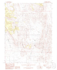
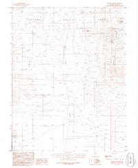
1986 Map of Mud Spring
USGS Topo · Published 1986About this map
Monitor Range dominates this portion of Nye County, where high-elevation terrain meets the open expanse of Fourmile Basin. This 1980s survey captures a landscape shaped by intermittent water sources and dramatic elevation changes within the Toiyabe National Forest. Vital water points such as Douglas Spring, Mud Spring, and Upper Mud Spring are documented, highlighting the essential nature of these features in the arid Great Basin environment. The drainage patterns are clearly defined by Saulsbury Wash and the deeply cut Woodchopper Canyon, illustrating how seasonal runoff has carved the slopes of the range over millennia. This map provides a precise record of the topography and natural landmarks prior to modern land-use changes in central Nevada.
Find a feature on this map
11 named features on this map. Tap any name to fly to it.
Don’t see what you’re looking for? This feature index may not catch every label — zoom into the map to look around manually.
Map Details
Editions of this 1986 Mud Spring Map
This is the sole edition of this map. No revisions or reprints were ever made.
Other maps of this area

1956 · Tonopah
USGS Topo · 1:250,000

1959 · Tonopah
USGS Topo · 1:250,000

1962 · Tonopah
USGS Topo · 1:250,000

1971 · Antelope Spring
USGS Topo · 1:24,000
1971 · Georges Canyon Rim
USGS Topo · 1:24,000

1971 · Saulsbury Basin
USGS Topo · 1:24,000

1986 · Stone Cabin Ranch
USGS Topo · 1:24,000
1986 · Hannapah
USGS Topo · 1:24,000
1986 · Stone Cabin Ranch SW
USGS Topo · 1:24,000
1986 · Yellow Cone
USGS Topo · 1:24,000