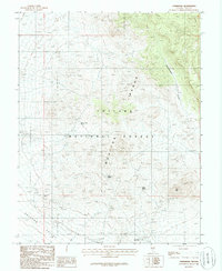
1986 Map of Hannapah
USGS Topo · Published 1986About this map
The high-desert mining landscape of Nye County is defined by the Monitor Range and the industrial remnants at Hannapah. This mid-1980s survey details a region where water and mineral wealth dictated human presence, marked by a scattering of vital water sources like Cedar Corral Spring, Parrotte Spring, and Prody Spring. The eastern edge of the Ralston Valley gives way to the protected lands of the Toiyabe National Forest, which covers the central uplands. Evidence of historical prospecting is pervasive throughout the terrain, with numerous prospects and localized mine shafts clustered near the southern settlements. Higher elevations are anchored by Red Peak, while the northern landscape is deeply carved by Woodchopper Canyon, reflecting the isolation and varied topography of this section of central Nevada.
Find a feature on this map
12 named features on this map. Tap any name to fly to it.
Don’t see what you’re looking for? This feature index may not catch every label — zoom into the map to look around manually.
Map Details
Editions of this 1986 Hannapah Map
This is the sole edition of this map. No revisions or reprints were ever made.
Other maps of this area

1907 · Tonopah
USGS Topo · 1:250,000

1908 · Tonopah
USGS Topo · 1:250,000

1956 · Tonopah
USGS Topo · 1:250,000

1959 · Tonopah
USGS Topo · 1:250,000

1961 · Tonopah
USGS Topo · 1:62,500

1962 · Tonopah
USGS Topo · 1:250,000

1963 · Baxter Spring
USGS Topo · 1:62,500

1971 · Antelope Spring
USGS Topo · 1:24,000

1971 · Saulsbury Basin
USGS Topo · 1:24,000
1986 · Mud Spring
USGS Topo · 1:24,000