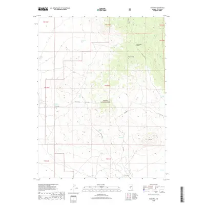
2018 Map of Hannapah
USGS Topo · Published 2018About this map
Monitor Range defines the high-desert character of this central Nevada landscape, where natural water sources dictated movement and survival in the high basin terrain. Within the Toiyabe National Forest, the topography rises toward Red Peak and drops into the steep contours of Woodchopper Canyon. The distribution of vital springs across the arid landscape indicates historical routes and ranching possibilities, with named points like Thunder Mountain Spring, Cedar Corral Spring, and Parrotte Spring serving as essential landmarks for navigation and land management. Regional travel is traced through designated routes such as Douglas Spring and Cedar Corral, which connect the isolated mountain slopes to the broader desert floor, revealing the sparse but deliberate settlement pattern of Nye County in the early twenty-first century.
Find a feature on this map
24 named features on this map. Tap any name to fly to it.
Don’t see what you’re looking for? This feature index may not catch every label — zoom into the map to look around manually.
Map Details
Editions of this 2018 Hannapah Map
This is the sole edition of this map. No revisions or reprints were ever made.
Other maps of this area

1907 · Tonopah
USGS Topo · 1:250,000

1908 · Tonopah
USGS Topo · 1:250,000

1956 · Tonopah
USGS Topo · 1:250,000

1959 · Tonopah
USGS Topo · 1:250,000

1961 · Tonopah
USGS Topo · 1:62,500

1962 · Tonopah
USGS Topo · 1:250,000

1963 · Baxter Spring
USGS Topo · 1:62,500

1971 · Antelope Spring
USGS Topo · 1:24,000

1971 · Saulsbury Basin
USGS Topo · 1:24,000
1986 · Mud Spring
USGS Topo · 1:24,000