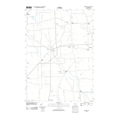
2010 Map of Hannibal
USGS Topo · Published 2010About this map
Ninemile Creek meanders through the heart of this Oswego County landscape, connecting a network of crossroads and agricultural hamlets. The village of Hannibal serves as a central hub, surrounded by smaller satellite communities including Hannibal Center, North Hannibal, and South Hannibal. This late-twentieth-century survey reveals a landscape deeply rooted in family farming, evidenced by landmarks like Wiltse's Fruit Farm and Enchantment Acres Flower Farm. The transport network is defined by rural routes like Co Rte 3 and Co Rte 85, while numerous burial grounds such as Fairdale Rural Cemetery and Mosher Cemetery offer vital reference points for local genealogy. The presence of Metcalf Siding indicates the area's historical rail connections, while water features like Sterling Valley Creek and Muck Creek drain the fertile lowlands of the region.
Find a feature on this map
65 named features on this map. Tap any name to fly to it.
Don’t see what you’re looking for? This feature index may not catch every label — zoom into the map to look around manually.
Map Details
Editions of this 2010 Hannibal Map
This is the sole edition of this map. No revisions or reprints were ever made.
Other maps of this area

1900 · Baldwinsville
USGS Topo · 1:62,500

1900 · Oswego
USGS Topo · 1:62,500

1900 · Fulton
USGS Topo · 1:62,500

1902 · Weedsport
USGS Topo · 1:62,500

1943 · Oswego East
USGS Topo · 1:31,680

1943 · Lysander
USGS Topo · 1:31,680

1943 · Oswego West
USGS Topo · 1:31,680

1943 · Cato
USGS Topo · 1:31,680

1943 · Hannibal
USGS Topo · 1:31,680

1943 · Fair Haven
USGS Topo · 1:31,680