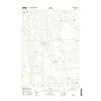
2016 Map of Hannibal
USGS Topo · Published 2016About this map
Hannibal and its surrounding hamlets occupy this rural stretch of upstate New York, where the boundary between Oswego Co and Cayuga Co divides the landscape. The terrain is defined by a series of north-south drainage networks including Ninemile Cr, Eightmile Cr, and Sterling Valley Cr, which navigate the drumlin-like hills and marshy lowlands typical of the Lake Ontario plains. The map reveals a dense network of local history through its many small cemeteries and dispersed settlement nodes like Hannibal Center, Fairdale, and Pember Corners. Genealogists and local historians can trace family locations through the numerous rural burial grounds such as Hannibal Cem, Fairdale Rural Cem, and the Mosher Cem near South Hannibal. The predominance of muck lands, specifically noted at Muck Cr, indicates the specialized agricultural history of the region, where peat and fertile bottomlands were often used for vegetable production.
Find a feature on this map
88 named features on this map. Tap any name to fly to it.
Don’t see what you’re looking for? This feature index may not catch every label — zoom into the map to look around manually.
Map Details
Editions of this 2016 Hannibal Map
This is the sole edition of this map. No revisions or reprints were ever made.
Other maps of this area

1900 · Baldwinsville
USGS Topo · 1:62,500

1900 · Oswego
USGS Topo · 1:62,500

1900 · Fulton
USGS Topo · 1:62,500

1902 · Weedsport
USGS Topo · 1:62,500

1943 · Oswego East
USGS Topo · 1:31,680

1943 · Lysander
USGS Topo · 1:31,680

1943 · Oswego West
USGS Topo · 1:31,680

1943 · Cato
USGS Topo · 1:31,680

1943 · Hannibal
USGS Topo · 1:31,680

1943 · Fair Haven
USGS Topo · 1:31,680