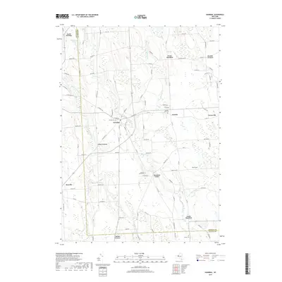
2019 Map of Hannibal
USGS Topo · Published 2019About this map
Hannibal serves as the central hub of this agricultural and creek-threaded landscape on the border of Oswego and Cayuga Counties. The geography is defined by a series of north-flowing waterways, including Sterling Valley Cr and Ninemile Cr, which create the drainage patterns for the surrounding hamlets. Small, localized settlements such as North Hannibal, Hannibal Center, and South Hannibal are scattered throughout the quadrangle, each marked by historical burial grounds like the Fairdale Rural Cem and Hannibal Center Cem. In the northwest corner, North Sterling sits near the headwaters of McMullen Pond, illustrating the persistent rural character of this region. The road network, including names like Peat Bed Rd and Muck Rd, hints at the local soil composition and the likely history of swamp drainage or specialized farming that has shaped the Oswego County countryside for generations.
Find a feature on this map
94 named features on this map. Tap any name to fly to it.
Don’t see what you’re looking for? This feature index may not catch every label — zoom into the map to look around manually.
Map Details
Editions of this 2019 Hannibal Map
This is the sole edition of this map. No revisions or reprints were ever made.
Other maps of this area

1900 · Baldwinsville
USGS Topo · 1:62,500

1900 · Oswego
USGS Topo · 1:62,500

1900 · Fulton
USGS Topo · 1:62,500

1902 · Weedsport
USGS Topo · 1:62,500

1943 · Oswego East
USGS Topo · 1:31,680

1943 · Lysander
USGS Topo · 1:31,680

1943 · Oswego West
USGS Topo · 1:31,680

1943 · Cato
USGS Topo · 1:31,680

1943 · Hannibal
USGS Topo · 1:31,680

1943 · Fair Haven
USGS Topo · 1:31,680