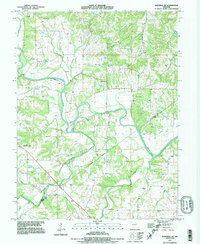
1991 Map of Hannibal SE
USGS Topo · Published 1995About this map
The Salt River meanders across this rural landscape in Ralls County, its course heavily managed by a prominent Levee system that snakes along the valley floor. The map captures a moment in the early 1990s when the region's agricultural character remained deeply tied to its watercourses, including Spencer Creek, Peno Creek, and Plum Creek. This topography is remarkably cemetery-dense, providing a vital resource for genealogists researching family lineages such as the Matson, Kiethley, and Pritchett families.
Find a feature on this map
32 named features on this map. Tap any name to fly to it.
Don’t see what you’re looking for? This feature index may not catch every label — zoom into the map to look around manually.
Map Details
Editions of this 1991 Hannibal SE Map
This is the sole edition of this map. No revisions or reprints were ever made.
Other maps of this area

1890 · Louisiana
USGS Topo · 1:125,000

1931 · Barry
USGS Topo · 1:62,500

1932 · Hannibal
USGS Topo · 1:62,500

1936 · Hannibal
USGS Topo · 1:48,000

1936 · Barry
USGS Topo · 1:48,000

1937 · Bowling Green
USGS Topo · 1:62,500

1940 · Bowling Green
USGS Topo · 1:62,500

1943 · Vandalia
USGS Topo · 1:62,500

1944 · Barry
USGS Topo · 1:62,500

1945 · Hannibal
USGS Topo · 1:62,500