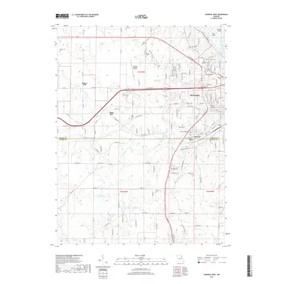
2017 Map of Hannibal West
USGS Topo · Published 2017About this map
The western outskirts of Hannibal transition from established urban neighborhoods into the varied landscape of northeastern Missouri. Along the eastern edge, the Hannibal-LaGrange University campus and residential developments like Coll Heights sit near the river bluffs. Moving west, the terrain is shaped by the complex hydrology of Bear Creek and its many tributaries, including Little Bear Creek and Minnow Branch. This network of waterways historically influenced settlement patterns at Withers Mill and White Bear, while contemporary land use is represented by the Hannibal Regional Airport and several large reservoirs like Charles Ransdell Lake and Bowmans Lake. The map details a significant concentration of local heritage sites, including the Saint Marys Cemetery, Mount Zion Cemetery, and Grand View Burial Park, alongside major transportation arteries like the Bnsf RR and US Highway 36.
Find a feature on this map
154 named features on this map. Tap any name to fly to it.
Don’t see what you’re looking for? This feature index may not catch every label — zoom into the map to look around manually.
Map Details
Editions of this 2017 Hannibal West Map
This is the sole edition of this map. No revisions or reprints were ever made.
Other maps of this area

1903 · Palmyra
USGS Topo · 1:125,000

1925 · Quincy
USGS Topo · 1:62,500

1932 · Hannibal
USGS Topo · 1:62,500

1936 · Hannibal
USGS Topo · 1:48,000

1944 · Quincy
USGS Topo · 1:62,500

1945 · Hannibal
USGS Topo · 1:62,500

1945 · Quincy
USGS Topo · 1:62,500

1948 · Quincy
USGS Topo · 1:250,000

1949 · Palmyra
USGS Topo · 1:24,000

1950 · Palmyra
USGS Topo · 1:24,000