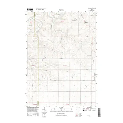
2015 Map of Hanover
USGS Topo · Published 2015About this map
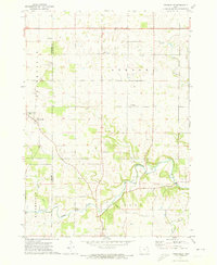
The Upper Iowa River carves a deep, winding path through the northern reaches of this landscape, its banks connected by crossings such as Hansens Ford Bridge and the Ellingson Bridge. The terrain transitions from the river valley to higher elevations marked by West Ridge and a network of ridge-top roads including W Ridge Rd and Oneill Ridge Rd. Settlement patterns reflect a rural community anchored by small hubs like Hanover, where Saint Patricks Cem and several family-named landmarks are situated.
Find a feature on this map
61 named features on this map. Tap any name to fly to it.
Don’t see what you’re looking for? This feature index may not catch every label — zoom into the map to look around manually.
Map Details
Editions of this 2015 Hanover Map
This is the sole edition of this map. No revisions or reprints were ever made.
Other maps of this area

1903 · Waukon
USGS Topo · 1:125,000

1906 · Decorah
USGS Topo · 1:125,000

1958 · La Crosse
USGS Topo · 1:250,000

1961 · La Crosse
USGS Topo · 1:250,000

1965 · La Crosse
USGS Topo · 1:250,000

1968 · Waukon
USGS Topo · 1:24,000
1968 · Waukon NW
USGS Topo · 1:24,000
1971 · Rossville
USGS Topo · 1:24,000
1971 · Dorchester
USGS Topo · 1:24,000
1971 · Frankville
USGS Topo · 1:24,000