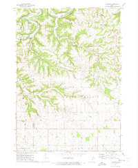
1971 Map of Hanover
USGS Topo · Published 1973About this map
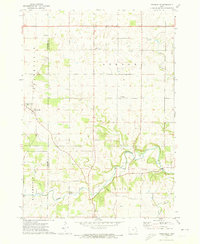
The Upper Iowa River cuts a deep, winding path through the northern reach of this quadrangle, defining a landscape where drainage systems like Canoe Creek and Patterson Creek dictate the local geography. In the early 1970s, the small settlement of Hanover serves as a focal point near the confluence of Mineral Creek, marked by the presence of St Marys Ch and St Patricks Cem. The map illustrates a rural economy reliant on the land, evidenced by several scattered Quarry sites and established townships like Union Prairie and Frankville. Along the western border, the boundary between Winneshiek and Allamakee Counties follows the rugged divides between these watersheds. Local heritage is deeply rooted in the countryside, with landmarks such as St Johns Ch, East Glenwood Cem, and Mount Olivet Cem situated on the higher ground of the plateaus.
Find a feature on this map
22 named features on this map. Tap any name to fly to it.
Don’t see what you’re looking for? This feature index may not catch every label — zoom into the map to look around manually.
Map Details
Editions of this 1971 Hanover Map
This is the sole edition of this map. No revisions or reprints were ever made.
Other maps of this area

1903 · Waukon
USGS Topo · 1:125,000

1906 · Decorah
USGS Topo · 1:125,000

1958 · La Crosse
USGS Topo · 1:250,000

1961 · La Crosse
USGS Topo · 1:250,000

1965 · La Crosse
USGS Topo · 1:250,000

1968 · Waukon
USGS Topo · 1:24,000
1968 · Waukon NW
USGS Topo · 1:24,000
1971 · Rossville
USGS Topo · 1:24,000
1971 · Dorchester
USGS Topo · 1:24,000
1971 · Frankville
USGS Topo · 1:24,000