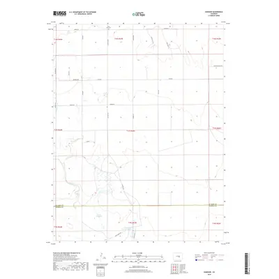
2019 Map of Hanover
USGS Topo · Published 2019About this map
Chico Basin Cem stands as a quiet cultural anchor in this portion of the high plains, situated near the intersection of S Peyton Hwy and Sagebrush Ln. The landscape is defined by its water management and agricultural infrastructure, most notably the Hanover Ditch Number 1 and several significant basins. The drainage of Chico Cr meanders through the terrain, feeding into or bypassing seasonal catchments like Smith Reservoir and the J N Holland Reservoir Number 2. The survey reveals a grid of rural connectivity where family names like Demmler, Apelt, and Chisman mark the local roads. This network of thoroughfares, including Apelt Ranch Rd and Hanover Rd, reflects the enduring ranching and land-management patterns that persist across the El Paso and Pueblo county line.
Find a feature on this map
33 named features on this map. Tap any name to fly to it.
Don’t see what you’re looking for? This feature index may not catch every label — zoom into the map to look around manually.
Map Details
Editions of this 2019 Hanover Map
This is the sole edition of this map. No revisions or reprints were ever made.
Other maps of this area

1891 · Pueblo
USGS Topo · 1:125,000

1891 · Nepesta
USGS Topo · 1:125,000

1893 · Nepesta
USGS Topo · 1:125,000

1893 · Big Springs
USGS Topo · 1:125,000

1893 · Colorado Springs
USGS Topo · 1:125,000

1894 · Pueblo
USGS Topo · 1:125,000

1896 · Pueblo
USGS Topo · 1:125,000

1897 · Pueblo
USGS Topo · 1:125,000

1904 · Nepesta
USGS Topo · 1:125,000

1909 · Colorado Springs
USGS Topo · 1:125,000