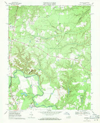
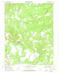
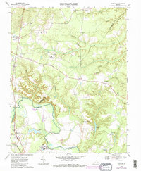
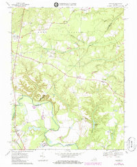
1969 Map of Hanover
USGS Topo · Published 1971About this map
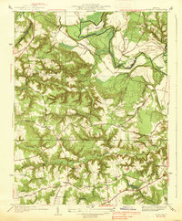
The Pamunkey River winds through the heart of this landscape, defining the boundary between Hanover, Caroline, and King William Counties. In the late 1960s, the area around the county seat of Hanover remained largely rural, characterized by scattered crossroads settlements like Mangohick, Dawn, and Calno. Institutional presence is notable on this sheet, with the Hanover School For Boys situated near the river and the State Prison Camp No 2 located further north along Herring Creek.
Find a feature on this map
50 named features on this map. Tap any name to fly to it.
Don’t see what you’re looking for? This feature index may not catch every label — zoom into the map to look around manually.
Map Details
Editions of this 1969 Hanover Map
4 editions found
Other maps of this area

1894 · Richmond
USGS Topo · 1:62,500

1895 · Richmond
USGS Topo · 1:62,500

1918 · Doswell
USGS Topo · 1:62,500

1918 · Aylett
USGS Topo · 1:62,500

1920 · King William
USGS Topo · 1:62,500

1933 · Aylett
USGS Topo · 1:62,500
1938 · Studley
USGS Topo · 1:31,680

1938 · Yellow Tavern
USGS Topo · 1:31,680

1943 · Richmond
USGS Topo · 1:250,000

1949 · Richmond
USGS Topo · 1:250,000