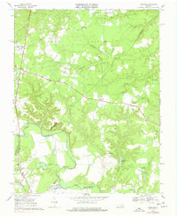
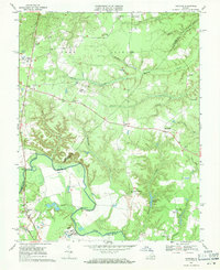
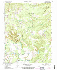
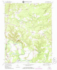
1969 Map of Hanover
USGS Topo · Published 1977About this map
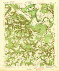
The Pamunkey River serves as the primary geographic divider on this sheet, winding through the southern landscape and defining the borders of Hanover Co, King William Co, and Caroline Co. This rural Virginia landscape is heavily marked by institutional land use, most notably the Hanover School For Boys and State Prison Camp No 2, alongside scattered agricultural settlements such as Mangohick and Etna Mills. The river's influence is evident in the low-lying Boot Swamp and the named fishing or navigation point at Sturgeon Hole.
Find a feature on this map
47 named features on this map. Tap any name to fly to it.
Don’t see what you’re looking for? This feature index may not catch every label — zoom into the map to look around manually.
Map Details
Editions of this 1969 Hanover Map
4 editions found
Other maps of this area

1894 · Richmond
USGS Topo · 1:62,500

1895 · Richmond
USGS Topo · 1:62,500

1918 · Doswell
USGS Topo · 1:62,500

1918 · Aylett
USGS Topo · 1:62,500

1920 · King William
USGS Topo · 1:62,500

1933 · Aylett
USGS Topo · 1:62,500
1938 · Studley
USGS Topo · 1:31,680

1938 · Yellow Tavern
USGS Topo · 1:31,680

1943 · Richmond
USGS Topo · 1:250,000

1949 · Richmond
USGS Topo · 1:250,000