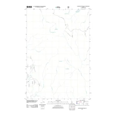
2011 Map of Hanover Mountain
USGS Topo · Published 2011About this map
High-altitude hydrology and forest access define this 2011 topographic survey of the central Idaho backcountry. The landscape is characterized by a high density of alpine basins, featuring Upper Slate Lake, Indigo Lake, and Emerald Lake. The drainages of Slate Creek and the Wind River dominate the northern and eastern portions of the map, while Hanover Creek flows through the central area. Human impact is primarily restricted to specialized forest management infrastructure, such as Moores Station Rd and Nat For Dev Rd 313, which provide access to this remote terrain. Researchers can observe the complex network of mountain streams, including Bentz Creek and Little Boulder Creek, which drain the ridges around Upper Knob Lake.
Find a feature on this map
21 named features on this map. Tap any name to fly to it.
Don’t see what you’re looking for? This feature index may not catch every label — zoom into the map to look around manually.
Map Details
Editions of this 2011 Hanover Mountain Map
This is the sole edition of this map. No revisions or reprints were ever made.
Other maps of this area

1931 · Buffalo Hump
USGS Topo · 1:125,000

1934 · Buffalo Hump
USGS Topo · 1:125,000

1938 · Riggins
USGS Topo · 1:96,000

1945 · Riggins
USGS Topo · 1:125,000

1955 · Grangeville
USGS Topo · 1:250,000

1956 · Burgdorf
USGS Topo · 1:62,500

1956 · Elk City
USGS Topo · 1:250,000

1959 · Grangeville
USGS Topo · 1:250,000

1960 · Elk City
USGS Topo · 1:250,000

1963 · Sourdough Peak
USGS Topo · 1:24,000