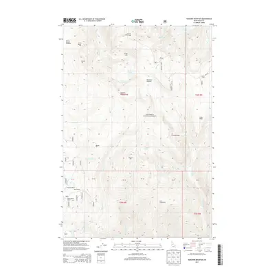
2013 Map of Hanover Mountain
USGS Topo · Published 2013About this map
Whiskey Bills Cabin and Wilson Cow Camp are small human outposts in a high-elevation Idaho landscape dominated by the peaks and drainages of the Nez Perce National Forest. The terrain is defined by dramatic elevation changes from Gospel Peak and Hanover Mtn down into the narrow riparian corridors of Slate Creek and the Wind River. This 2013 survey illustrates a wilderness characterized by alpine lakes and meadows, including the Slate Lakes, Indigo Lake, and Emerald Lake. At the southern end of the sheet, names like Florence Basin and Last Chance Gulch hint at the region's historical associations with mining and pioneer exploration, while the network of creeks like Hanover Creek and Meadow Creek feed the larger river systems of Idaho County.
Find a feature on this map
84 named features on this map. Tap any name to fly to it.
Don’t see what you’re looking for? This feature index may not catch every label — zoom into the map to look around manually.
Map Details
Editions of this 2013 Hanover Mountain Map
This is the sole edition of this map. No revisions or reprints were ever made.
Other maps of this area

1931 · Buffalo Hump
USGS Topo · 1:125,000

1934 · Buffalo Hump
USGS Topo · 1:125,000

1938 · Riggins
USGS Topo · 1:96,000

1945 · Riggins
USGS Topo · 1:125,000

1955 · Grangeville
USGS Topo · 1:250,000

1956 · Burgdorf
USGS Topo · 1:62,500

1956 · Elk City
USGS Topo · 1:250,000

1959 · Grangeville
USGS Topo · 1:250,000

1960 · Elk City
USGS Topo · 1:250,000

1963 · Sourdough Peak
USGS Topo · 1:24,000