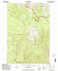
1995 Map of Hanover Mountain
USGS Topo · Published 1999About this map
Gospel Peak and Hanover Mountain dominate this mid-1990s survey of the high country within the Gospel Hump Wilderness. The map details a landscape defined by sharp elevation changes and high-altitude water bodies like Indigo Lake, Emerald Lake, and the sapphire-blue Slate Lake. Human activity in the Nez Perce National Forest is evidenced by the remote Wixon Cow Camp and Moores Work Center, indicating the ongoing importance of forest management and seasonal grazing. The drainage network is complex, with Slate Creek, Meadow Creek, and the Wind River carving through the terrain. Evidence of earlier exploration or prospecting persists in named locations like Last Chance Gulch near Florence Basin, while numerous Meadows, such as Round Bottom Meadows and Rhett Meadows, suggest pockets of relatively level ground amid the surrounding peaks.
Find a feature on this map
49 named features on this map. Tap any name to fly to it.
Don’t see what you’re looking for? This feature index may not catch every label — zoom into the map to look around manually.
Map Details
Editions of this 1995 Hanover Mountain Map
This is the sole edition of this map. No revisions or reprints were ever made.
Other maps of this area

1931 · Buffalo Hump
USGS Topo · 1:125,000

1934 · Buffalo Hump
USGS Topo · 1:125,000

1938 · Riggins
USGS Topo · 1:96,000

1945 · Riggins
USGS Topo · 1:125,000

1955 · Grangeville
USGS Topo · 1:250,000

1956 · Burgdorf
USGS Topo · 1:62,500

1956 · Elk City
USGS Topo · 1:250,000

1959 · Grangeville
USGS Topo · 1:250,000

1960 · Elk City
USGS Topo · 1:250,000

1963 · Sourdough Peak
USGS Topo · 1:24,000