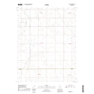
2019 Map of Hanover SE
USGS Topo · Published 2019About this map
Black Squirrel Cr cuts a significant path through the southern plains of Colorado, carving through a landscape defined by expansive township and range sections. This 2019 survey documents the rural character of the borderlands between El Paso and Pueblo counties, where the high desert terrain is marked by a sparse network of section-line roads and family-named routes. The mapping reveals a distinct settlement pattern of large parcels and modern rural subdivisions along Mountain Prairie Dr and Meadow Brook Dr. Historical transportation corridors like Squirrel Creek Rd and S Squirrel Creek Rd track the drainage of the creek, while the county line between El Paso and Pueblo counties serves as a primary geographic anchor for the region's administrative history.
Find a feature on this map
14 named features on this map. Tap any name to fly to it.
Don’t see what you’re looking for? This feature index may not catch every label — zoom into the map to look around manually.
Map Details
Editions of this 2019 Hanover SE Map
This is the sole edition of this map. No revisions or reprints were ever made.
Other maps of this area

1891 · Nepesta
USGS Topo · 1:125,000

1893 · Nepesta
USGS Topo · 1:125,000

1893 · Big Springs
USGS Topo · 1:125,000

1904 · Nepesta
USGS Topo · 1:125,000
1954 · Hanover NW
USGS Topo · 1:24,000
1954 · Hanover
USGS Topo · 1:24,000

1954 · Pueblo
USGS Topo · 1:250,000

1957 · Pueblo
USGS Topo · 1:250,000

1958 · Pueblo
USGS Topo · 1:250,000

1959 · Highlands Church
USGS Topo · 1:24,000