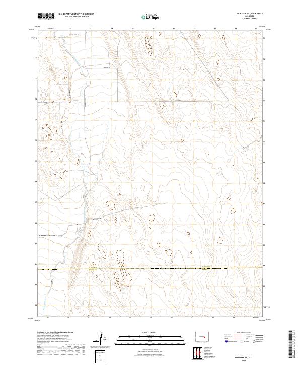
2022 Map of Hanover SE
USGS Topo · Published 2022About this map
Black Squirrel Cr meanders through this section of the High Plains, carving a distinct north-south path through a landscape defined by the expansive grid of the Public Land Survey System. The area is characterized by a sparse network of rural roads that follow section lines and topography, including Squirrel Creek Rd and Myers Rd. The southern portion of the sheet is bisected by the county boundary between El Paso Co and Pueblo Co, illustrating the administrative division of this open range. Modern residential development is suggested by localized clusters of named thoroughfares like Mountain Prairie Dr and Meadow Brook Dr, which deviate from the traditional square grid. This 2022 survey documents the transition between the rolling prairie and emerging rural residential corridors, showing how the drainage of Black Squirrel Cr remains the primary natural landmark in a region increasingly shaped by modern road infrastructure.
Find a feature on this map
14 named features on this map. Tap any name to fly to it.
Don’t see what you’re looking for? This feature index may not catch every label — zoom into the map to look around manually.
Map Details
Editions of this 2022 Hanover SE Map
This is the sole edition of this map. No revisions or reprints were ever made.
Other maps of this area

1891 · Nepesta
USGS Topo · 1:125,000

1893 · Nepesta
USGS Topo · 1:125,000

1893 · Big Springs
USGS Topo · 1:125,000

1904 · Nepesta
USGS Topo · 1:125,000
1954 · Hanover NW
USGS Topo · 1:24,000
1954 · Hanover
USGS Topo · 1:24,000

1954 · Pueblo
USGS Topo · 1:250,000

1957 · Pueblo
USGS Topo · 1:250,000

1958 · Pueblo
USGS Topo · 1:250,000

1959 · Highlands Church
USGS Topo · 1:24,000