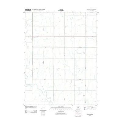
2012 Map of Hanover SE
USGS Topo · Published 2012About this map
The Little Blue River winds through the southwestern corner of this Marshall County landscape, anchoring a drainage network that defines the region’s topography. This 2012 survey illustrates a classic Midwestern rural grid, where section lines like Zenith Rd and Indian Rd segment the territory into orderly agricultural parcels. The drainage system is particularly dense, with numerous tributaries including Bolling Creek, Walnut Creek, and the E Fork Walnut Creek etching across the plains.
Find a feature on this map
36 named features on this map. Tap any name to fly to it.
Don’t see what you’re looking for? This feature index may not catch every label — zoom into the map to look around manually.
Map Details
Editions of this 2012 Hanover SE Map
This is the sole edition of this map. No revisions or reprints were ever made.
Other maps of this area

1889 · Marysville
USGS Topo · 1:125,000

1894 · Marysville
USGS Topo · 1:125,000

1955 · Manhattan
USGS Topo · 1:250,000

1956 · Manhattan
USGS Topo · 1:250,000

1957 · Manhattan
USGS Topo · 1:250,000

1966 · Marysville
USGS Topo · 1:24,000

1966 · Hanover SE
USGS Topo · 1:24,000

1966 · Hanover SW
USGS Topo · 1:24,000
1966 · Herkimer
USGS Topo · 1:24,000
1966 · Hanover West
USGS Topo · 1:24,000