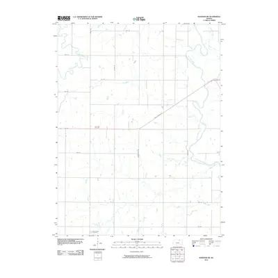
2010 Map of Hanover SW
USGS Topo · Published 2010About this map
Saint Paul Cemetery and Mount Jesus Cemetery anchor this rural landscape in Washington County, providing critical landmarks for genealogists and local historians. The area is defined by its creek-fed topography, where the Little Blue River winds through the eastern portion of the quadrangle, joined by tributaries such as Jonah Creek and Beaver Creek.
Find a feature on this map
24 named features on this map. Tap any name to fly to it.
Don’t see what you’re looking for? This feature index may not catch every label — zoom into the map to look around manually.
Map Details
Editions of this 2010 Hanover SW Map
This is the sole edition of this map. No revisions or reprints were ever made.
Other maps of this area

1889 · Marysville
USGS Topo · 1:125,000

1893 · Washington
USGS Topo · 1:125,000

1894 · Marysville
USGS Topo · 1:125,000

1955 · Manhattan
USGS Topo · 1:250,000

1956 · Manhattan
USGS Topo · 1:250,000

1957 · Manhattan
USGS Topo · 1:250,000

1966 · Washington
USGS Topo · 1:24,000

1966 · Hanover SE
USGS Topo · 1:24,000

1966 · Hanover SW
USGS Topo · 1:24,000
1966 · Washington NE
USGS Topo · 1:24,000