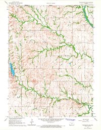
1966 Map of Washington NE
USGS Topo · Published 1967About this map
Washington County State Park dominates the western edge of this agricultural landscape in north-central Kansas, providing a recreation-focused contrast to the surrounding section-line roads and farmsteads. The topography is defined by the winding course of the Little Blue River in the northeast and a series of westward-draining waterways including Spring Creek, Devils Creek, and Mill Cr. Cultural history is anchored by the Union Pacific railroad corridor and local burial sites like Silver Cliff Cem and Gaskill Cem.
Find a feature on this map
16 named features on this map. Tap any name to fly to it.
Don’t see what you’re looking for? This feature index may not catch every label — zoom into the map to look around manually.
Map Details
Editions of this 1966 Washington NE Map
This is the sole edition of this map. No revisions or reprints were ever made.
Other maps of this area

1889 · Marysville
USGS Topo · 1:125,000

1893 · Washington
USGS Topo · 1:125,000

1894 · Marysville
USGS Topo · 1:125,000

1955 · Manhattan
USGS Topo · 1:250,000

1955 · Lincoln
USGS Topo · 1:250,000

1956 · Manhattan
USGS Topo · 1:250,000

1957 · Manhattan
USGS Topo · 1:250,000

1957 · Lincoln
USGS Topo · 1:250,000

1958 · Lincoln
USGS Topo · 1:250,000

1960 · Fairbury SW
USGS Topo · 1:24,000