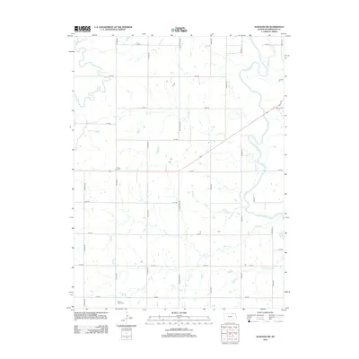
2012 Map of Hanover SW
USGS Topo · Published 2012About this map
The Little Blue River winds through this section of Washington County, defining a landscape of deep drainage and fertile creek bottoms. In the northern reaches, smaller tributaries like Cottonwood Cr and Cedar Cr join the river as it moves through the prairie. The human imprint on this land is marked by a rigorous section-line grid, where roads like Wagon Train Rd and Upland Rd cross the rolling terrain. For those tracing local history or family roots, two prominent landmarks serve as anchors: Saint Paul Cem in the central portion and Mount Jesus Cem to the south. These sites, along with the numerous creeks like Beaver Cr and Malone Cr, reveal the long-standing rural structure of this Kansas farming region.
Find a feature on this map
28 named features on this map. Tap any name to fly to it.
Don’t see what you’re looking for? This feature index may not catch every label — zoom into the map to look around manually.
Map Details
Editions of this 2012 Hanover SW Map
This is the sole edition of this map. No revisions or reprints were ever made.
Other maps of this area

1889 · Marysville
USGS Topo · 1:125,000

1893 · Washington
USGS Topo · 1:125,000

1894 · Marysville
USGS Topo · 1:125,000

1955 · Manhattan
USGS Topo · 1:250,000

1956 · Manhattan
USGS Topo · 1:250,000

1957 · Manhattan
USGS Topo · 1:250,000

1966 · Washington
USGS Topo · 1:24,000

1966 · Hanover SE
USGS Topo · 1:24,000

1966 · Hanover SW
USGS Topo · 1:24,000
1966 · Washington NE
USGS Topo · 1:24,000