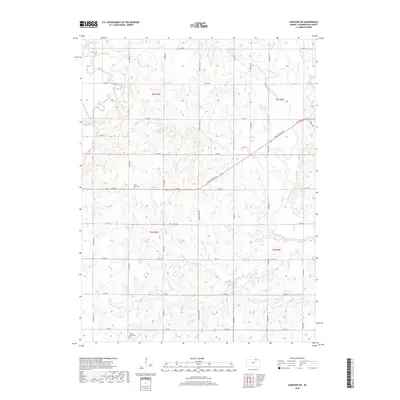
2018 Map of Hanover SW
USGS Topo · Published 2018About this map
The Little Blue River and its meandering tributaries carve through the rural landscape of Washington County in this 2018 survey. The terrain is defined by a dense network of local roads following the section lines of the Public Land Survey System, including Wagon Train Rd and Pony Express Ave, reflecting the historical transit corridors of the region. Local history is anchored by the presence of Saint Paul Cem and Mount Jesus Cem, which serve as permanent markers of early settlement patterns in this agricultural heartland. Numerous small waterways, such as Mill Creek, Cedar Cr, and Lane Br, drain the land toward the river, creating a complex series of draws and ridges that have influenced the placement of farms and homesteads for generations.
Find a feature on this map
32 named features on this map. Tap any name to fly to it.
Don’t see what you’re looking for? This feature index may not catch every label — zoom into the map to look around manually.
Map Details
Editions of this 2018 Hanover SW Map
This is the sole edition of this map. No revisions or reprints were ever made.
Other maps of this area

1889 · Marysville
USGS Topo · 1:125,000

1893 · Washington
USGS Topo · 1:125,000

1894 · Marysville
USGS Topo · 1:125,000

1955 · Manhattan
USGS Topo · 1:250,000

1956 · Manhattan
USGS Topo · 1:250,000

1957 · Manhattan
USGS Topo · 1:250,000

1966 · Washington
USGS Topo · 1:24,000

1966 · Hanover SE
USGS Topo · 1:24,000

1966 · Hanover SW
USGS Topo · 1:24,000
1966 · Washington NE
USGS Topo · 1:24,000