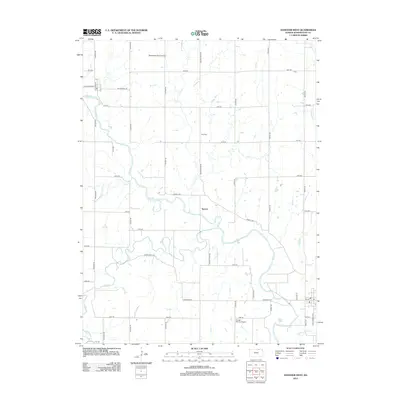
2012 Map of Hanover West
USGS Topo · Published 2012About this map
The Little Blue River meanders across this rural Washington County landscape, anchoring a network of family farms and agricultural infrastructure in the early 21st century. The small community of Spence sits along the river's northern banks, connected to the surrounding countryside by a grid of numbered roads and named thoroughfares such as Bonds Mill Ave and Wagon Train RD. This area reflects a long-standing reliance on local watercourses like Mill Cr and Joy Cr for drainage and resources, while the presence of the Prall Cem offers a point of interest for those researching local family lineages. Private aviation infrastructure is evident through the Wasseman Farms Airport in the north and the Coufal-Warren Airport to the south, highlighting the modern logistical needs of this expansive prairie region.
Find a feature on this map
40 named features on this map. Tap any name to fly to it.
Don’t see what you’re looking for? This feature index may not catch every label — zoom into the map to look around manually.
Map Details
Editions of this 2012 Hanover West Map
This is the sole edition of this map. No revisions or reprints were ever made.
Other maps of this area

1889 · Marysville
USGS Topo · 1:125,000

1893 · Washington
USGS Topo · 1:125,000

1894 · Marysville
USGS Topo · 1:125,000

1955 · Manhattan
USGS Topo · 1:250,000

1955 · Lincoln
USGS Topo · 1:250,000

1956 · Manhattan
USGS Topo · 1:250,000

1957 · Manhattan
USGS Topo · 1:250,000

1957 · Lincoln
USGS Topo · 1:250,000

1958 · Lincoln
USGS Topo · 1:250,000

1966 · Washington
USGS Topo · 1:24,000