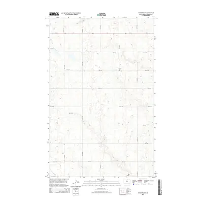
2014 Map of Hansboro SW
USGS Topo · Published 2014About this map
Big Coulee defines the drainage pattern of this Towner County landscape, winding northwest to southeast through a grid of section roads and rural intersections. The land use is dominated by a strict section-line transportation network, including major thoroughfares like Us-281 and ND-5 that cross the northern part of the quadrangle. For genealogists and local historians, the presence of the Finnish Cem and Mt View Cem provides specific points of interest tied to the early settlement and community heritage of this prairie region. These landmarks, along with a series of numbered avenues and streets such as 56th Ave NE and 97th St NE, illustrate the transition between organized agricultural surveying and the natural watercourses that still dictate the area's geography.
Find a feature on this map
18 named features on this map. Tap any name to fly to it.
Don’t see what you’re looking for? This feature index may not catch every label — zoom into the map to look around manually.
Map Details
Editions of this 2014 Hansboro SW Map
This is the sole edition of this map. No revisions or reprints were ever made.
Other maps of this area

1953 · Devils Lake
USGS Topo · 1:250,000

1956 · Devils Lake
USGS Topo · 1:250,000
1969 · Hansboro NE
USGS Topo · 1:24,000
1969 · Hansboro
USGS Topo · 1:24,000

1969 · Rolla NE
USGS Topo · 1:24,000

1970 · Hansboro SW
USGS Topo · 1:24,000

1970 · Hansboro SE
USGS Topo · 1:24,000

1970 · Rolla
USGS Topo · 1:24,000

1971 · Mylo
USGS Topo · 1:24,000

1971 · Bisbee North
USGS Topo · 1:24,000