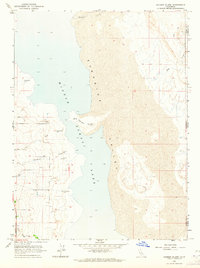
1963 Map of Hansen Island
USGS Topo · Published 1964About this map
Middle Alkali Lake dominates the center of this 1963 survey, reflecting the arid hydrology of eastern Modoc County. The shoreline is characterized by numerous water sources, including a series of Flowing Wells and Springs that supported the early ranching efforts in the western Surprise Valley. The presence of Cottonwood Creek and Owl Creek suggest seasonal drainages that provided vital water to the lowlands along Surprise Valley Road. On the eastern shore, the terrain rises toward the California-Nevada state line, where the landscape is crossed by a Jeep Trail and intermittent drainages like Bull Creek. The map documents a sparsely settled region where survival was closely tied to the few named water features like Fortynine Creek and the central prominence of Hansen Island.
Find a feature on this map
15 named features on this map. Tap any name to fly to it.
Don’t see what you’re looking for? This feature index may not catch every label — zoom into the map to look around manually.
Map Details
Editions of this 1963 Hansen Island Map
2 editions found
Other maps of this area

1886 · Alturas
USGS Topo · 1:250,000

1889 · Long Valley
USGS Topo · 1:250,000

1892 · Alturas
USGS Topo · 1:250,000

1954 · Vya
USGS Topo · 1:250,000

1954 · Alturas
USGS Topo · 1:250,000

1958 · Alturas
USGS Topo · 1:250,000

1958 · Vya
USGS Topo · 1:250,000

1962 · Alturas
USGS Topo · 1:250,000

1962 · Vya
USGS Topo · 1:250,000

1962 · Cedarville
USGS Topo · 1:62,500