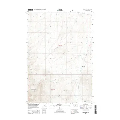
2014 Map of Hansen Ranch
USGS Topo · Published 2014About this map
Medicine Lodge Cr flows through the heart of this Montana landscape, tracing a path through the valley that serves as a primary corridor for travel along Medicine Lodge Rd. This 2014 survey documents the isolated ranching and federal lands of Beaverhead County, where the eponymous Hansen Ranch sits near the confluence of Poole Cr. To the southwest, the boundary of the Beaverhead National Forest marks a transition into more dramatic vertical relief, characterized by the steep drainage of Harkness Cr. The map captures a topography defined by significant drainages and canyons, including Baker Canyon and Kissick Canyon, which illustrate the complex watershed systems that feed into the larger creek beds. This document is a clear record of land use and water rights in a region where cattle ranching and public forest management define the local economy.
Find a feature on this map
14 named features on this map. Tap any name to fly to it.
Don’t see what you’re looking for? This feature index may not catch every label — zoom into the map to look around manually.
Map Details
Editions of this 2014 Hansen Ranch Map
This is the sole edition of this map. No revisions or reprints were ever made.
Other maps of this area

1893 · Dillon
USGS Topo · 1:250,000

1952 · Eli Spring
USGS Topo · 1:24,000

1955 · Dubois
USGS Topo · 1:250,000

1955 · Dillon
USGS Topo · 1:250,000

1957 · Dillon
USGS Topo · 1:250,000

1958 · Dubois
USGS Topo · 1:250,000

1958 · Dillon
USGS Topo · 1:250,000

1959 · Grant
USGS Topo · 1:62,500

1962 · Dillon
USGS Topo · 1:250,000
1965 · Garfield Canyon
USGS Topo · 1:24,000