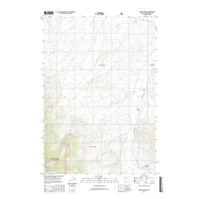
2017 Map of Hansen Ranch
USGS Topo · Published 2017About this map
Hansen Ranch sits as the central point of activity in this high-country landscape of Beaverhead County, where the topography is defined by the drainage basins of Medicine Lodge Cr and Barrett Cr. The terrain rises sharply toward the southwest into the Beaverhead National Forest, a region marked by deep cuts like Baker Canyon and Kissick Canyon. The road network is sparse, centered primarily on the winding path of Medicine Lodge Rd, which follows the natural valley floor to connect the ranching operations with the surrounding wilderness. Numerous small tributaries including Harkness Cr, Noble Cr, and Hansen Cr dissect the slopes, illustrating the complex watershed system that supports this remote part of Montana. This survey provides a clear view of the relationship between early 21st-century land use and the formidable natural barriers of the northern Rockies.
Find a feature on this map
15 named features on this map. Tap any name to fly to it.
Don’t see what you’re looking for? This feature index may not catch every label — zoom into the map to look around manually.
Map Details
Editions of this 2017 Hansen Ranch Map
This is the sole edition of this map. No revisions or reprints were ever made.
Other maps of this area

1893 · Dillon
USGS Topo · 1:250,000

1952 · Eli Spring
USGS Topo · 1:24,000

1955 · Dubois
USGS Topo · 1:250,000

1955 · Dillon
USGS Topo · 1:250,000

1957 · Dillon
USGS Topo · 1:250,000

1958 · Dubois
USGS Topo · 1:250,000

1958 · Dillon
USGS Topo · 1:250,000

1959 · Grant
USGS Topo · 1:62,500

1962 · Dillon
USGS Topo · 1:250,000
1965 · Garfield Canyon
USGS Topo · 1:24,000