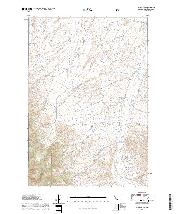
2024 Map of Hansen Ranch
USGS Topo · Published 2024About this map
The high drainages of the Tendoy Mountains dominate this landscape in the southwestern corner of the state, where the Beaverhead National Forest covers the steep slopes of the southwest quadrant. This area is defined by a network of seasonal and perennial waterways, including Poole Creek, Noble Creek, and Hansen Creek, which carve through the high-elevation terrain. A primary artery for the region is Medicine Lodge Rd, which runs north-to-south along the eastern valley of Medicine Lodge Creek. The map documents a rugged cattle-ranching and public-land interface, where township boundaries like t11s r12w intersect with complex topography such as Baker Canyon and Kissick Canyon.
Find a feature on this map
15 named features on this map. Tap any name to fly to it.
Don’t see what you’re looking for? This feature index may not catch every label — zoom into the map to look around manually.
Map Details
Editions of this 2024 Hansen Ranch Map
This is the sole edition of this map. No revisions or reprints were ever made.
Other maps of this area

1893 · Dillon
USGS Topo · 1:250,000

1952 · Eli Spring
USGS Topo · 1:24,000

1955 · Dubois
USGS Topo · 1:250,000

1955 · Dillon
USGS Topo · 1:250,000

1957 · Dillon
USGS Topo · 1:250,000

1958 · Dubois
USGS Topo · 1:250,000

1958 · Dillon
USGS Topo · 1:250,000

1959 · Grant
USGS Topo · 1:62,500

1962 · Dillon
USGS Topo · 1:250,000
1965 · Garfield Canyon
USGS Topo · 1:24,000