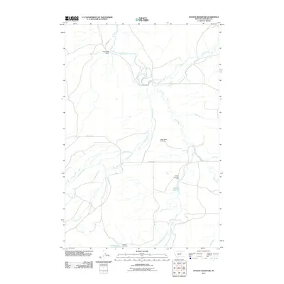
2011 Map of Hanson Reservoir
USGS Topo · Published 2011About this map
The Smith River winds through this central Montana landscape, defining a territory where managed water resources and ranch roads intersect. In this part of Meagher County, the infrastructure of the Hanson Reservoir Dam and Jackson Lake Dam indicates a reliance on water storage for the surrounding valley. The small settlement at Thompson Gulch sits near the northern boundary, serving as a focal point for local transit along Canyon Rd.
Find a feature on this map
21 named features on this map. Tap any name to fly to it.
Don’t see what you’re looking for? This feature index may not catch every label — zoom into the map to look around manually.
Map Details
Editions of this 2011 Hanson Reservoir Map
This is the sole edition of this map. No revisions or reprints were ever made.
Other maps of this area

1886 · Fort Logan
USGS Topo · 1:250,000

1886 · Little Belt Mts.
USGS Topo · 1:250,000

1894 · Little Belt Mts.
USGS Topo · 1:250,000

1897 · Little Belt Mts.
USGS Topo · 1:250,000

1898 · Little Belt Mts.
USGS Topo · 1:250,000

1902 · Little Belt Mts.
USGS Topo · 1:250,000

1948 · White Sulphur Springs
USGS Topo · 1:250,000

1958 · White Sulphur Springs
USGS Topo · 1:250,000

1961 · White Sulphur Springs
USGS Topo · 1:250,000

1965 · White Sulphur Springs
USGS Topo · 1:250,000