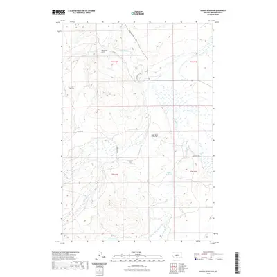
2020 Map of Hanson Reservoir
USGS Topo · Published 2020About this map
The Smith River winds through the central corridor of this Meagher County landscape, creating a focal point for the surrounding ranching and riparian terrain. This 2020 survey highlights the prominence of the Galt Ranch Airport and its connection to the remote ranching operations of central Montana. Notable geographic features such as Upper Birch Creek Bar and Lower Birch Creek Bar illustrate the depositional history along the drainage systems of Big Birch Cr and its tributaries. The map also detail various upland reservoirs and natural catchments, including Hanson Reservoir and Jackson Lake, which are essential for water management in this semi-arid environment. The road network, including Fort Logan Rd and Birch Creek Rd, reflects the long-standing routes connecting historic outposts and modern ranch holdings across the township lines.
Find a feature on this map
25 named features on this map. Tap any name to fly to it.
Don’t see what you’re looking for? This feature index may not catch every label — zoom into the map to look around manually.
Map Details
Editions of this 2020 Hanson Reservoir Map
This is the sole edition of this map. No revisions or reprints were ever made.
Other maps of this area

1886 · Fort Logan
USGS Topo · 1:250,000

1886 · Little Belt Mts.
USGS Topo · 1:250,000

1894 · Little Belt Mts.
USGS Topo · 1:250,000

1897 · Little Belt Mts.
USGS Topo · 1:250,000

1898 · Little Belt Mts.
USGS Topo · 1:250,000

1902 · Little Belt Mts.
USGS Topo · 1:250,000

1948 · White Sulphur Springs
USGS Topo · 1:250,000

1958 · White Sulphur Springs
USGS Topo · 1:250,000

1961 · White Sulphur Springs
USGS Topo · 1:250,000

1965 · White Sulphur Springs
USGS Topo · 1:250,000