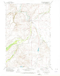
1971 Map of Hanson Reservoir
USGS Topo · Published 1975About this map
The Smith River winds through this Meagher County landscape, carving a deep valley that separates the western uplands from the eastern drainages. The terrain is characterized by prominent benchlands known as Upper Birch Creek Bar and Lower Birch Creek Bar, which suggest the historic path of water through this high-altitude cattle country. To the south, the Hanson Reservoir and Jackson Lake provide essential water storage in a region dominated by seasonal drainages like Big Birch Creek and Little Birch Creek. The presence of several Spring and Springs labels, alongside a Gravel Pit, points to the modest resource extraction and ranching infrastructure typical of the area during the early 1970s. This survey records a network of unimproved roads and fence lines that define property and land use before modern development altered these traditional boundaries.
Find a feature on this map
19 named features on this map. Tap any name to fly to it.
Don’t see what you’re looking for? This feature index may not catch every label — zoom into the map to look around manually.
Map Details
Editions of this 1971 Hanson Reservoir Map
This is the sole edition of this map. No revisions or reprints were ever made.
Other maps of this area

1886 · Fort Logan
USGS Topo · 1:250,000

1886 · Little Belt Mts.
USGS Topo · 1:250,000

1894 · Little Belt Mts.
USGS Topo · 1:250,000

1897 · Little Belt Mts.
USGS Topo · 1:250,000

1898 · Little Belt Mts.
USGS Topo · 1:250,000

1902 · Little Belt Mts.
USGS Topo · 1:250,000

1948 · White Sulphur Springs
USGS Topo · 1:250,000

1958 · White Sulphur Springs
USGS Topo · 1:250,000

1961 · White Sulphur Springs
USGS Topo · 1:250,000

1965 · White Sulphur Springs
USGS Topo · 1:250,000