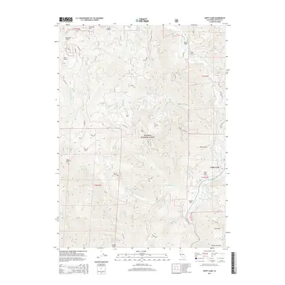
2015 Map of Happy Camp
USGS Topo · Published 2015About this map
Happy Camp serves as the focal point of this survey, situated where Indian Creek meets the wide bend of the Klamath River. The town's connection to the wider region is anchored by the Happy Camp Airport, while the surrounding landscape is defined by the steep, drainage-cut slopes of the Klamath National Forest. Notable watercourses like Elk Creek and Little Grider Cr feed into the main river valley, which provides a level corridor for settlements like Deason Flat. High-elevation landmarks such as Baldy Mtn and the northern edge of the Marble Mountains frame the horizon, while the terrain is etched with humorously named forest roads including Hot Potato, Jeffries Joke, and Clean Sweep. Small residential pockets and named landmarks like Phillips Gulch illustrate the localized pattern of mountain living in this river-valley community.
Find a feature on this map
45 named features on this map. Tap any name to fly to it.
Don’t see what you’re looking for? This feature index may not catch every label — zoom into the map to look around manually.
Map Details
Editions of this 2015 Happy Camp Map
This is the sole edition of this map. No revisions or reprints were ever made.
Other maps of this area

1914 · Seiad
USGS Topo · 1:125,000

1922 · Preston Peak
USGS Topo · 1:125,000

1922 · Seiad
USGS Topo · 1:125,000

1948 · Weed
USGS Topo · 1:250,000

1950 · Weed
USGS Topo · 1:250,000

1955 · Dillon Mtn
USGS Topo · 1:62,500

1955 · Ukonom Lake
USGS Topo · 1:62,500

1956 · Happy Camp
USGS Topo · 1:62,500

1956 · Preston Peak
USGS Topo · 1:62,500

1958 · Weed
USGS Topo · 1:250,000