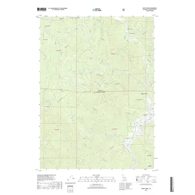
2018 Map of Happy Camp
USGS Topo · Published 2018About this map
Happy Camp serves as the central hub of this Northern California landscape, situated where Indian Creek meets the winding Klamath River. The 2018 survey reveals a terrain defined by steep ridges and deep gulches within the Klamath National Forest, showing the intricate network of forest roads and ties that crisscross the mountainsides. Notable peaks and landmarks include Baldy Mtn, Runaway Point, and the Marble Mountains visible to the southeast.
Find a feature on this map
58 named features on this map. Tap any name to fly to it.
Don’t see what you’re looking for? This feature index may not catch every label — zoom into the map to look around manually.
Map Details
Editions of this 2018 Happy Camp Map
This is the sole edition of this map. No revisions or reprints were ever made.
Other maps of this area

1914 · Seiad
USGS Topo · 1:125,000

1922 · Preston Peak
USGS Topo · 1:125,000

1922 · Seiad
USGS Topo · 1:125,000

1948 · Weed
USGS Topo · 1:250,000

1950 · Weed
USGS Topo · 1:250,000

1955 · Dillon Mtn
USGS Topo · 1:62,500

1955 · Ukonom Lake
USGS Topo · 1:62,500

1956 · Happy Camp
USGS Topo · 1:62,500

1956 · Preston Peak
USGS Topo · 1:62,500

1958 · Weed
USGS Topo · 1:250,000