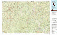
1983 Map of Happy Camp
USGS Topo · Published 1984About this map
Happy Camp sits at the heart of this early 1980s survey, marking a vital settlement node along the Klamath River where it meets Indian Creek. This region of Northern California and Southern Oregon is defined by the heavy intersection of the Siskiyou Mountains and Klamath Mountains, where deep drainage systems like Clear Creek and Thompson Creek dictate the movement of both water and early road networks. The landscape is heavily industrial, evidenced by a high density of mining operations such as High Plateau Mine, Classic Hill Mine, and Buzzard Hill Mine.
Find a feature on this map
156 named features on this map. Tap any name to fly to it.
Don’t see what you’re looking for? This feature index may not catch every label — zoom into the map to look around manually.
Map Details
Editions of this 1983 Happy Camp Map
This is the sole edition of this map. No revisions or reprints were ever made.
Other maps of this area

1886 · Shasta
USGS Topo · 1:250,000

1891 · Ashland
USGS Topo · 1:250,000

1893 · Ashland
USGS Topo · 1:250,000

1894 · Shasta
USGS Topo · 1:250,000

1897 · Ashland
USGS Topo · 1:250,000

1908 · Grants Pass
USGS Topo · 1:125,000

1914 · Seiad
USGS Topo · 1:125,000

1917 · Kerby
USGS Topo · 1:125,000

1918 · Kerby
USGS Topo · 1:125,000

1922 · Preston Peak
USGS Topo · 1:125,000