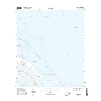
2015 Map of Happy Jack
USGS Topo · Published 2015About this map
The Mississippi River carves through the lower delta in this detailed 2015 study, with the settlement of Port Sulphur anchoring the western bank. This area of Plaquemines Parish shows the intricate relationship between the river's main channel and the surrounding marshlands, evidenced by the Pointe A La Hache Relief Outlet and the complex web of canals like Fosters Canal. The landscape is dominated by a fragile network of coastal features such as Grand Point Bay and Drum Island, separated by numerous passes including Triple Pass leading toward the Gulf of Mexico. Smaller communities like Happy Jack, Point Michel, and Encalade are clustered along the river corridor, following the higher ground established by natural levees and reinforced by infrastructure like La 23. The presence of the Bohemia Cem on the eastern bank serves as a silent reminder of earlier settlement patterns in this dynamic estuarine environment.
Find a feature on this map
63 named features on this map. Tap any name to fly to it.
Don’t see what you’re looking for? This feature index may not catch every label — zoom into the map to look around manually.
Map Details
Editions of this 2015 Happy Jack Map
This is the sole edition of this map. No revisions or reprints were ever made.
Other maps of this area

1891 · Pointe a La Hache
USGS Topo · 1:62,500

1892 · Quarantine
USGS Topo · 1:62,500

1892 · Pointe a La Hache
USGS Topo · 1:62,500

1893 · Fort Livingston
USGS Topo · 1:62,500

1893 · Dime
USGS Topo · 1:62,500

1935 · Port Sulphur
USGS Topo · 1:31,680

1935 · Lake Calebasse
USGS Topo · 1:31,680

1935 · Lake Batola
USGS Topo · 1:31,680

1935 · Tropical Bend
USGS Topo · 1:31,680

1939 · Pointe a La Hache
USGS Topo · 1:62,500