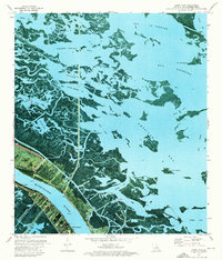
1973 Map of Happy Jack
USGS Topo · Published 1976About this map
The Mississippi River defines the lower-left corner of this map, where the settlements of Happy Jack and Port Sulphur are concentrated along the narrow levee lands. This 1970s orthophotomap combines aerial photography with topographic detail, illustrating the precarious balance between the river's industrial corridor and the encroaching coastal wetlands. While the riverbank supports structures like the Acadian Sch and a system of protection at Back Levee, the majority of the landscape is a complex network of marsh and open water, including Grand Point Bay and American Bay. This era of mapping shows the intricate waterways such as John Bayou Canal and Battle Ground Bay, which reveal the area's history as a hub for both navigation and wildlife conservation within the Bohemia State Wildlife Management Area.
Find a feature on this map
45 named features on this map. Tap any name to fly to it.
Don’t see what you’re looking for? This feature index may not catch every label — zoom into the map to look around manually.
Map Details
Editions of this 1973 Happy Jack Map
This is the sole edition of this map. No revisions or reprints were ever made.
Other maps of this area

1891 · Pointe a La Hache
USGS Topo · 1:62,500

1892 · Quarantine
USGS Topo · 1:62,500

1892 · Pointe a La Hache
USGS Topo · 1:62,500

1893 · Fort Livingston
USGS Topo · 1:62,500

1893 · Dime
USGS Topo · 1:62,500

1935 · Port Sulphur
USGS Topo · 1:31,680

1935 · Lake Calebasse
USGS Topo · 1:31,680

1935 · Lake Batola
USGS Topo · 1:31,680

1935 · Tropical Bend
USGS Topo · 1:31,680

1939 · Pointe a La Hache
USGS Topo · 1:62,500