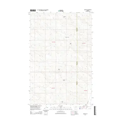
2014 Map of Harb SW
USGS Topo · Published 2014About this map
Pickhandle Coulee and Windmill Coulee define the drainage patterns of this high-plains landscape where Phillips Co and Valley Co meet. This 2014 survey documents a territory dominated by seasonal waterways and legal land divisions, showing the precise township and range lines such as t27n r33e. In the southeast corner, the primary transportation artery, Larb Creek Rd, follows the course of Larb Cr as it winds through the basin. Local nomenclature for the intermittent streams, including Albert Coulee, Trueblood Coulee, and Grove Coulee, reflects the ranching history and family names associated with these drainages. The map serves as a record of the public land survey system and the water-scarce geography typical of the eastern Montana rangelands.
Find a feature on this map
13 named features on this map. Tap any name to fly to it.
Don’t see what you’re looking for? This feature index may not catch every label — zoom into the map to look around manually.
Map Details
Editions of this 2014 Harb SW Map
This is the sole edition of this map. No revisions or reprints were ever made.
Other maps of this area

1954 · Jordan
USGS Topo · 1:250,000

1954 · Glasgow
USGS Topo · 1:250,000

1956 · Jordan
USGS Topo · 1:250,000

1957 · Glasgow
USGS Topo · 1:250,000

1958 · Glasgow
USGS Topo · 1:250,000

1958 · Jordan
USGS Topo · 1:250,000

1964 · Jordan
USGS Topo · 1:250,000

1965 · Buckley Lake
USGS Topo · 1:24,000

1973 · Niles Coulee
USGS Topo · 1:24,000
1973 · White Horse Coulee
USGS Topo · 1:24,000