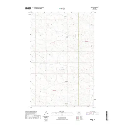
2020 Map of Harb SW
USGS Topo · Published 2020About this map
Pickhandle Coulee and Windmill Coulee define the drainage patterns of this high-plains landscape where the border of Phillips County and Valley County runs north-to-south. The area is characterized by these deeply etched coulees, including Albert Coulee and Trueblood Coulee, which create a complex network of seasonal watercourses across the ranching country. Larb Creek Rd provides the primary access in the southeastern portion of the quadrangle, skirting the edge of the drainage near Grove Coulee. This U.S. Geological Survey representation of the terrain captures the vast, open character of the region as it existed in 2020, illustrating how the natural topography has dictated the placement of roads and boundary lines in this part of Montana.
Find a feature on this map
12 named features on this map. Tap any name to fly to it.
Don’t see what you’re looking for? This feature index may not catch every label — zoom into the map to look around manually.
Map Details
Editions of this 2020 Harb SW Map
This is the sole edition of this map. No revisions or reprints were ever made.
Other maps of this area

1954 · Jordan
USGS Topo · 1:250,000

1954 · Glasgow
USGS Topo · 1:250,000

1956 · Jordan
USGS Topo · 1:250,000

1957 · Glasgow
USGS Topo · 1:250,000

1958 · Glasgow
USGS Topo · 1:250,000

1958 · Jordan
USGS Topo · 1:250,000

1964 · Jordan
USGS Topo · 1:250,000

1965 · Buckley Lake
USGS Topo · 1:24,000

1973 · Niles Coulee
USGS Topo · 1:24,000
1973 · White Horse Coulee
USGS Topo · 1:24,000