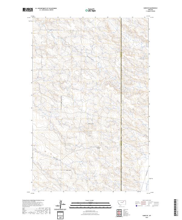
2024 Map of Harb SW
USGS Topo · Published 2024About this map
The border between Phillips and Valley counties cuts through this high plains landscape, defined by a series of significant drainage systems. The terrain is deeply grooved by Windmill Coulee, Albert Coulee, and Trueblood Coulee, all of which move water toward the eastern edge of the quadrangle. These coulees represent the primary topographic features in an otherwise open range, providing critical drainage for the surrounding sections of Township 27 North, Range 33 East and its neighbors.
Find a feature on this map
11 named features on this map. Tap any name to fly to it.
Don’t see what you’re looking for? This feature index may not catch every label — zoom into the map to look around manually.
Map Details
Editions of this 2024 Harb SW Map
This is the sole edition of this map. No revisions or reprints were ever made.
Other maps of this area

1954 · Jordan
USGS Topo · 1:250,000

1954 · Glasgow
USGS Topo · 1:250,000

1956 · Jordan
USGS Topo · 1:250,000

1957 · Glasgow
USGS Topo · 1:250,000

1958 · Glasgow
USGS Topo · 1:250,000

1958 · Jordan
USGS Topo · 1:250,000

1964 · Jordan
USGS Topo · 1:250,000

1965 · Buckley Lake
USGS Topo · 1:24,000

1973 · Niles Coulee
USGS Topo · 1:24,000
1973 · White Horse Coulee
USGS Topo · 1:24,000