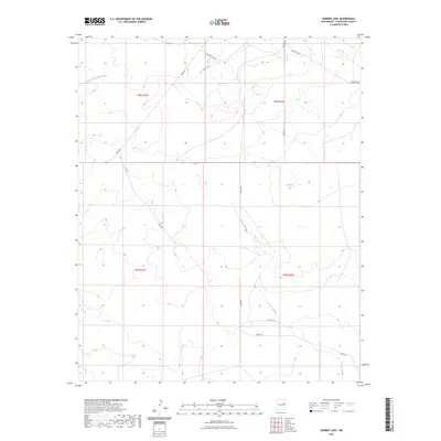
2023 Map of Harben Lake
USGS Topo · Published 2023About this map
Harben Lake sits within a wide, arid landscape of Guadalupe County, defined by the seasonal drainage patterns of the Pecos River basin. The terrain is marked by significant ephemeral watercourses, including Arroyo Potrillo which winds through the southern and eastern sectors, and Cuervito Creek in the north. This modern survey illustrates the sparse, high-plains ranching infrastructure characteristic of eastern New Mexico, where long-established range roads like Corriente Rd and Sneed Rd provide access across the vast township divisions. The intersection of local routes such as Cross Rd and Robin Rd highlights the remote nature of the region, where the naming of even small water features like Arroyo San Juan de Dios remains essential for local orientation and land management.
Find a feature on this map
17 named features on this map. Tap any name to fly to it.
Don’t see what you’re looking for? This feature index may not catch every label — zoom into the map to look around manually.
Map Details
Editions of this 2023 Harben Lake Map
This is the sole edition of this map. No revisions or reprints were ever made.
Other maps of this area

1892 · Corazon
USGS Topo · 1:125,000

1894 · Corazon
USGS Topo · 1:125,000

1954 · Santa Fe
USGS Topo · 1:250,000

1954 · Fort Sumner
USGS Topo · 1:250,000

1958 · Fort Sumner
USGS Topo · 1:250,000

1958 · Santa Fe
USGS Topo · 1:250,000

1963 · Sunshine Mesa
USGS Topo · 1:24,000

1963 · Puerto De Luna
USGS Topo · 1:24,000

1963 · Sacaton Draw
USGS Topo · 1:24,000

1963 · Cuervo
USGS Topo · 1:24,000