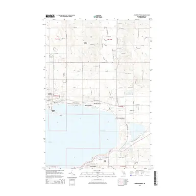
2014 Map of Harbor Springs
USGS Topo · Published 2014About this map
Little Traverse Bay defines the geography of this northern Michigan coastline, where the historic resort communities of Harbor Springs and Petoskey face each other across the deep water. The shoreline is punctuated by long-established summer associations and neighborhoods including Wequetonsing, Roaring Brook, Ramona Park, and Menonaqua Beach. Inland from the bay, the landscape transitions from the concentrated grid of the Harbor Point peninsula to the sprawling recreational and residential developments near Emmet Heights and Patons Corner. The map captures a high level of detail along the waterfront, showing the Harbor Springs Airport and the religious and cultural hub of Bay View. Further inland, the presence of the N Country National Scenic Trail winding through the hills indicates the region's modern evolution into a premier outdoor destination, while local landmarks like Lakeview Cem offer grounding for genealogical research in Emmet County.
Find a feature on this map
113 named features on this map. Tap any name to fly to it.
Don’t see what you’re looking for? This feature index may not catch every label — zoom into the map to look around manually.
Map Details
Editions of this 2014 Harbor Springs Map
This is the sole edition of this map. No revisions or reprints were ever made.
Other maps of this area

1955 · Cheboygan
USGS Topo · 1:250,000

1958 · Cheboygan
USGS Topo · 1:250,000

1958 · Cross Village
USGS Topo · 1:62,500

1958 · Pellston
USGS Topo · 1:62,500

1958 · Bayshore
USGS Topo · 1:62,500

1958 · Petoskey
USGS Topo · 1:62,500

1975 · Petoskey NW
USGS Topo · 1:24,000

1975 · Petoskey SW
USGS Topo · 1:24,000

1975 · Petoskey NE
USGS Topo · 1:24,000

1982 · Petoskey
USGS Topo · 1:100,000