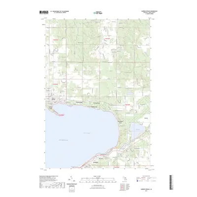
2023 Map of Harbor Springs
USGS Topo · Published 2023About this map
Little Traverse Bay defines the geography of this northern Michigan coastline, where the historic waterfront communities of Harbor Springs and Petoskey face one another across the deep waters of Lake Michigan. The shoreline between these centers is a continuous string of seasonal and residential enclaves, including Wequetonsing, Roaring Brook, and Ramona Park. Significant cultural history is marked by the Holy Childhood Indian Cem and the St Francis Solanus Cem, reflecting the area's deep indigenous and missionary roots. Inland from the bay, the terrain rises toward Emmet Heights, while the North Country National Scenic Trl winds through the eastern hills. The transition from the developed waterfront to the interior is marked by landmarks like the Harbor Springs Airport and the smaller inland waters of Round Lake and Mud Lake near Conway.
Find a feature on this map
139 named features on this map. Tap any name to fly to it.
Don’t see what you’re looking for? This feature index may not catch every label — zoom into the map to look around manually.
Map Details
Editions of this 2023 Harbor Springs Map
This is the sole edition of this map. No revisions or reprints were ever made.
Other maps of this area

1955 · Cheboygan
USGS Topo · 1:250,000

1958 · Cheboygan
USGS Topo · 1:250,000

1958 · Cross Village
USGS Topo · 1:62,500

1958 · Pellston
USGS Topo · 1:62,500

1958 · Bayshore
USGS Topo · 1:62,500

1958 · Petoskey
USGS Topo · 1:62,500

1975 · Petoskey NW
USGS Topo · 1:24,000

1975 · Petoskey SW
USGS Topo · 1:24,000

1975 · Petoskey NE
USGS Topo · 1:24,000

1982 · Petoskey
USGS Topo · 1:100,000
Featured Places
- Petoskey, MI
- Harbor Springs, MI
- Friendship Township, MI
- Bear Creek Township, MI
- Little Traverse Township, MI