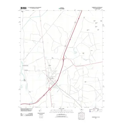
2011 Map of Hardeeville
USGS Topo · Published 2011About this map
The settlement of Hardeeville serves as the focal point of this coastal plain survey, situated where regional highways intersect near the Savannah River. The map documents a landscape defined by low-lying terrain and local nomenclature, including family-named heights such as Mill Hill, Sassafras Hill, and Laurel Knoll. For genealogists, the inclusion of the White Hardee Cemetery and Sancie Cemetery provides specific points for family history research.
Find a feature on this map
49 named features on this map. Tap any name to fly to it.
Don’t see what you’re looking for? This feature index may not catch every label — zoom into the map to look around manually.
Map Details
Editions of this 2011 Hardeeville Map
This is the sole edition of this map. No revisions or reprints were ever made.
Other maps of this area

1920 · Hardeeville
USGS Topo · 1:62,500

1920 · Okatie
USGS Topo · 1:62,500

1920 · Bluffton
USGS Topo · 1:62,500

1942 · Savannah
USGS Topo · 1:62,500

1942 · Okatie
USGS Topo · 1:62,500

1943 · Hardeeville
USGS Topo · 1:62,500

1945 · Bluffton
USGS Topo · 1:62,500

1947 · Savannah
USGS Topo · 1:250,000

1948 · Savannah
USGS Topo · 1:250,000

1953 · Hardeeville
USGS Topo · 1:62,500