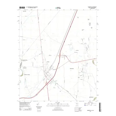
2014 Map of Hardeeville
USGS Topo · Published 2014About this map
Hardeeville serves as the central hub of this South Carolina lowcountry landscape, where the transport corridor of Whyte Hardee Blvd and local roads meet the riverine history of the Savannah R. To the west, the riverbank is marked by landings that recall the area's colonial and maritime past, specifically Purysburgh Landing and Mill Stone Landing. These points once facilitated movement along the Georgia-South Carolina border long before modern highways bypassed the river's edge.
Find a feature on this map
79 named features on this map. Tap any name to fly to it.
Don’t see what you’re looking for? This feature index may not catch every label — zoom into the map to look around manually.
Map Details
Editions of this 2014 Hardeeville Map
This is the sole edition of this map. No revisions or reprints were ever made.
Other maps of this area

1920 · Hardeeville
USGS Topo · 1:62,500

1920 · Okatie
USGS Topo · 1:62,500

1920 · Bluffton
USGS Topo · 1:62,500

1942 · Savannah
USGS Topo · 1:62,500

1942 · Okatie
USGS Topo · 1:62,500

1943 · Hardeeville
USGS Topo · 1:62,500

1945 · Bluffton
USGS Topo · 1:62,500

1947 · Savannah
USGS Topo · 1:250,000

1948 · Savannah
USGS Topo · 1:250,000

1953 · Hardeeville
USGS Topo · 1:62,500