
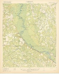
1920 Map of Hardeeville
USGS Topo · Published 1920About this map
The Savannah River defines the border between Georgia and South Carolina in this reconnaissance survey, revealing a landscape where river transport and early rail networks intersect. This era shows the decline of historic river crossings, marked by the noted Becks Ferry (Abandoned) and Sisters Ferry. The South Carolina side features the riverfront settlement of Purrysburg and the rail hub at Hardeeville, while the Georgia interior includes Rincon along the Seaboard Line.
Find a feature on this map
71 named features on this map. Tap any name to fly to it.
Don’t see what you’re looking for? This feature index may not catch every label — zoom into the map to look around manually.
Map Details
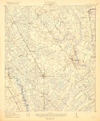
Editions of this 1920 Hardeeville Map
This is the sole edition of this map. No revisions or reprints were ever made.
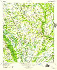
Other maps of this area

1918 · Yemassee
USGS Topo · 1:62,500

1919 · Pineland
USGS Topo · 1:62,500
1919 · Shirley
USGS Topo · 1:62,500
1919 · Egypt
USGS Topo · 1:62,500

1920 · Okatie
USGS Topo · 1:62,500

1920 · Meldrim
USGS Topo · 1:62,500

1920 · Bluffton
USGS Topo · 1:62,500
1939 · Egypt
USGS Topo · 1:62,500
1942 · Meldrim
USGS Topo · 1:62,500

1942 · Savannah
USGS Topo · 1:62,500